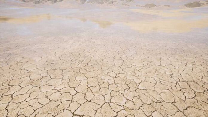
A potentially damaging flash drought could be in store for the midwest, officials have said, after May has proven to be a rather dry month for the region.
In northeastern Illinois, a region of the country that hasn’t experienced a soaking of rain since the early part of April, a flash drought “appears to be developing,” according to the National Weather Service. In a tweet sent recently, the service wrote:
“Be careful with open flames during the holiday weekend.”
As of late May, the city of Chicago has only gotten 0.42 inches of rain for the month, and there isn’t any more rain in the upcoming forecast before June rolls around. If that proves true, and no more rain falls during the month, then May of 2023 will end up being “the second driest on record behind May 1992.”
The region last had rain back on April 4, which is quite a long time for an area that’s not used to this type of drought. Many officials have also said that this pattern of no rainfall could be expected to continue through June.
Indiana is experiencing similar very dry conditions, combined with rising temperatures.
A flash drought happens any time that drought conditions are experienced rather severely and quickly over a very short time period. Typically speaking, flash droughts happen within a few weeks or even days.
They occur any time there’s a combination of temperatures that are very high and rainfall that’s well below the typical average. When this happens, it can lead to the climate changing rapidly in the region.
In recent days, the city of Chicago as well as the greater northeast Illinois region have experienced higher-than-normal temperatures, above 80 degrees. Cooler temperatures have been experienced, though, the closer you get to Lake Michigan.
Inconsistent weather is actually the norm for the city of Chicago and surrounding region, seeing as it’s positioned almost in the exact middle of North America. There are plenty of weather extremes that are experienced in all seasons in Chicago, from brutally cold winters to blazingly hot summers.
Lake Michigan is a major contributing factor to this. Because it is so large and has so much water, it actually generates unique weather patterns all on its own.
For instance, a boat capsized in early May in Lake Michigan near the 31st Beach after a huge gust of wind suddenly appeared to drastically alter the temperatures in the region.
A weather phenomenon called a “pneumonia front” was to blame for that incident. It happens just in this region of the country, when Lake Michigan’s cool winds come inland fast and cause the temperatures to drastically drop in a very short period of time.
According to the National Weather Service, when this happens, the temperature drops by as much as 16 degrees in roughly one hour at a time. It occurs most frequently between April and July.
Regions on the coast, by contrast, have their weather tempered by both the Atlantic and Pacific oceans.


